|
3D Maps |
|---|
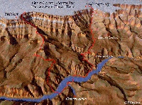 Bright Angel and South Kaibab trails
Original
Click here for full size image
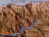 Bright Angel and South Kaibab trails
Modified to show more "stuff"
Click here for full size image
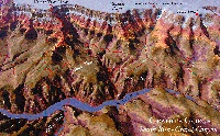 Granite Gorge showing Bright Angel, South Kaibab, Tonto and River Trails - Spectacular!
Large, high-res image - 410K, 792 x 493 JPEG
Medium, low-res image - 185K, 600 x 373 JPEG
Small, low-res image - 85K, 400 x 249 JPEG
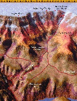 Close-up on Bright Angel and Plateau Point Trails
Large, high-res image - 571K, 722 x 943 JPEG
Medium, low-res image - 210K, 459 x 600 JPEG
Small, low-res image - 98K, 306 x 400 JPEG
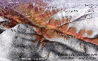 Bright Angel Canyon showing North Kaibab and Old Bright Angel Trails
Large, high-res image - 332K, 792x495 JPEG
Medium, low-res image - 175K, 600x375 JPEG
Small, low-res image - 81K, 400x250 JPEG
Christopher Settimi has been producing 3 dimensional topographic illustrations for about a
year now. He uses USGS DEM data as a starting point, then jazzes them up quite
a bit with trails and features.
He has most all the digital topographic data for the Grand Canyon area, and could
probably do more trails if you would like.
E-mail chris@pdgroup.com
voice 317.272.0882
fax 317.272.0883
Copyright © Bob Ribokas, 1994-2000, all rights reserved. This publication and its text and photos may not be copied for commercial use without the express written permission of Bob Ribokas.